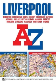
Liverpool A-Z Street Atlas (paperback): (New Seventh edition)
This A-Z map of Liverpool is a full colour, paperback street atlas featuring 120 pages of continuous street mapping which extends to include:*Maghull*Crosby*Bootle*Kirkby*Prescot*Huyton*St. Helens*Haydock*Widnes*Runcorn*Wallasey*Birkenhead*West Kirby*Heswall Also included is:*a large scale city centre map of Liverpool*a postcode map of the Liverpool area*a Liverpool rail connections map, featured on the outside back cover Postcode districts, one-way streets, park and ride sites and safety camera locations with their maximum speed limits are featured on the mapping. The index section lists streets, selected flats, walkways and places of interest, place, area and station names. There is a separate list of hospitals, NHS Walk-in Centres and hospices covered by this atlas.
£6.95
Similar Deals

Nudie Jeans Start your own f*cking brand book Colour: ...
£20.00
From Fat Buddha Store

Skratch Labs Feed Zone Portables Cookbook
£21.99
From Tredz

Pilgrim Paths in Ireland Book
£12.99
From Jackson Sport

Irish Canoe Classics Book
£16.99
From Jackson Sport

Log Book Holder Book
£14.99
From Jackson Sport

Donegal Sligo Leitrim Book
£12.99
From Jackson Sport

Carrauntoohil & MacGillycuddys Reeks Book
£12.99
From Jackson Sport

Belfast Twelve City Walks Guide Book
£12.00
From Jackson Sport

