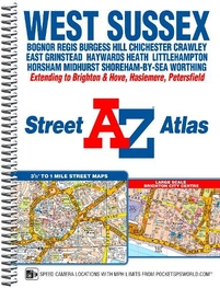
West Sussex A-Z Street Atlas: (New Third edition)
This A-Z map of West Sussex is a spiral bound street atlas featuring complete countywide coverage in a single book. The atlas contains 180 pages of coloured street mapping covering:*Arundel BillingshurstBognor RegisBurgess HillChichesterCrawleyCuckfieldEast GrinsteadHassocksHaywards HeathHorshamLittlehamptonMiddleton-on-SeaMidhurstPetworthSelseyShoreham-by-SeaSteyningStorringtonWorthing Also included is coverage of Brighton and Hove, Haslemere and Petersfield and a large scale town centre map of Brighton. Postcode districts, one-way streets, safety camera locations with speed limits and the South Downs National Park boundary are featured on the street mapping. The index section lists streets; selected flats, walkways and places of interest; place, area and railway station names. There is a separate index to hospitals and hospices covered by this atlas.
£11.95
Similar Deals

Wimpy Kid Rowley: Backpack Notes
£3.99
From Stanfords

Nudie Jeans Start your own f*cking brand book Colour: ...
£20.00
From Fat Buddha Store

Skratch Labs Feed Zone Table Cookbook
£21.99
From Tredz

Mont Blanc & the Aiguille Rouges Book
£14.95
From Jackson Sport

Mournes Climbing Guide Book
£21.00
From Jackson Sport

Sea Kayak Book
£15.99
From Jackson Sport

Carrauntoohil & MacGillycuddys Reeks Book
£12.99
From Jackson Sport

Dalkey Quarry Book
£20.00
From Jackson Sport

