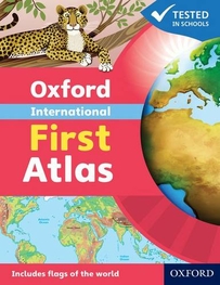
Oxford International First Atlas (2011)
Have you ever wondered...* What the Earth looks like from space?* How many continents there are?* Where Mount Everest is?Find out in your very first atlas!The Oxford International First Atlas is a stimulating first atlas for young children. It is completely up-to-date with accurate, easy-to-read and colourful mapping, presented in an accessible visual layout based on research into how young children use maps. It introduces young learners to maps and develops early atlas skills, encouraging them to talk about local and distant places and to find key places on maps. It includes:* An introduction to the globe and places around the world* Stunning images of the Earth from space* Clear and colourful maps of the world and all the continents* Popular themes such as world animals and holidays* Fascinating facts about places and people.The Oxford International First Atlas is also accompanied by the Activity Book for independent work to develop map literacy skills. Full colour
£8.99
Similar Deals

Skratch Labs The Feed Zone Cookbook
£21.99
From Tredz

The West Highland Way 11th Edition Book
£16.99
From Jackson Sport

The Northern Caminos Book
£16.95
From Jackson Sport

Wicklow Climbing Guide Book
£17.50
From Jackson Sport

Mournes Walks Book
£8.99
From Jackson Sport

The West Highland Way Waterproof Map
£9.99
From Jackson Sport

Carrauntoohil & MacGillycuddys Reeks Book
£12.99
From Jackson Sport

Sea Kayak Navigation Book
£11.99
From Jackson Sport

