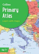
Collins Primary Atlas x 30
So – you know the basics of maps and how to find places on them. But what next? What else can you do with maps? The answer is LOTS! For example, landscape maps show you what the physical environment of a place looks like. (Think rivers, hills and landmarks.) Political maps show you where the boundaries of different countries are. Maps also use scale, grid references, compass points, keys and symbols to give you useful information. Find out how maps do all these things and more in this colourful atlas, which includes each country’s national flag! A bright atlas that supports the KS2 geography curriculumColoured political maps of the world with national flagsContinental relief maps which highlight physical featuresTeaches map-reading concepts such as scale and symbolsIncludes mapping of relevant topics for Key Stage 2Perfect for children aged 7-11 at school or at homeSupplied as a pack of 30 copies. #sum-18-ie
£239.70 £203.00
Similar Deals

London Map 1000 Piece Puzzle
£16.00
From Stanfords

The Kremlin Conspiracy: 1,000 Years of Russian Expansionism
£12.99
From Stanfords

The Sound of Things Falling
£9.99
From Stanfords

National Geographic Kids Readers: Penguins (National Geographic Kids Readers: Level 2)
£3.99
From Stanfords

Those Who Are Loved
£20.00
From Stanfords

London: Second Edition
£39.99
From Stanfords

Mathematical Games Knowledge Cards
£7.99
From Stanfords

What in the World Am I?
£6.50
From Stanfords

