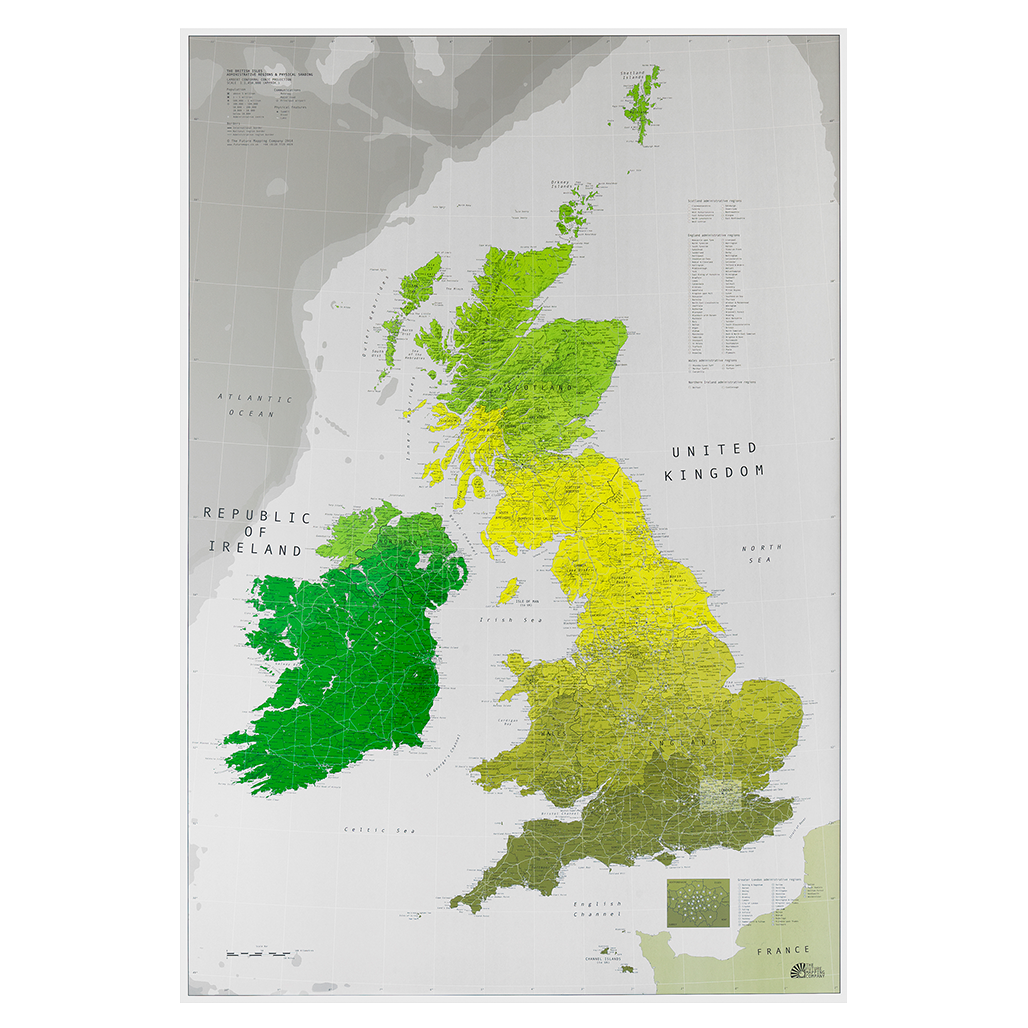
British Isles Wall Map
Accurate and attractive. With the islands shown in correct relationship to the mainland, plus list of administrative regions. This map is a rarity as it shows the islands in their correct relationships to the mainland, yes, the Channel Islands are down there (practically in France) and Shetland really is half way to Norway. Wherever we live in Britain we are a nation of map lovers. If no longer because we are all off sailing the seven seas, then because we have the world\'s most wonderfully ridiculous place names, Unthank and Upsettlington being a couple of our favourites. Or perhaps it\'s because we\'re fiercely regional, proud of our accents and local delicacies, even if they\'re whelks, eels or pork scratchings. The maps are printed to the highest quality FSC approved silk-coated paper using a lithographic printing process. This works like a mechanised version of traditional screen-printing. A plate is made for each colour and then laid down individually, offering a stunning-quality print, with great definition and colour impact. A sealer is applied to protect the inks and gloss UV varnish used to add contrast and highlight boundaries.
£29.00
Similar Deals

ClipAir - Nasal Dilator and Breathing Aid
£9.95
From Tower Health

Painmaster Micro Current Therapy Patches
£24.95
From Tower Health

iTouch Sure Pelvic Floor Exerciser
£49.95
From Tower Health

Posture Medic + Free Fisiocrem 60ml
£29.95
From Tower Health

Pure Vitamin C Powder 1000mg
£14.95
From Tower Health

Diabetic Cushioning Insoles
£12.00
From Tower Health

Staydry Everyday Underwear-Boxers-Pk Of 3-S
£29.99
From Easylife Group
Deluxe Passive Leg Exerciser
£99.99
From Easylife Group

